147 CEDAR ST
Owner Information
DEDHAM TOWN OF
26 BRYANT ST
DEDHAM, MA 02026


Property Details
147 CEDAR ST is classified as a Improved, Education (Municipal or County) (Schools-public).
The primary structure on this property was built in 1902. There are 62,508ft2 of built area within this property. There is 51,798ft2 of residential/living space within this property.
147 CEDAR ST is valued at $10,725,500. The land is valued at $1,435,900 and the structures are valued at $9,289,600.
This property is in Zone B. Confirm with local Zoning Board authorities to ensure there are no overlays or other easements on this property.
The most recent deed for 147 CEDAR ST is recorded at the local registrar in Book 2695, Page 382. 147 CEDAR ST was last sold on Wednesday, June 25, 1947 for $0.
Assessment data from fiscal year 2020.
Flood Data
According to the FEMA National Flood Hazard Layer, this property does not appear to be in a flood zone. It may also be in an area not yet reviewed. Nonetheless, confirm this information prior to taking any action.
To view the flood hazards around this property, create a FEMA "Firmette" Map of the area around 147 CEDAR ST.
Broadband Internet Providers
| Provider | Type | Bandwidth (mbps) | |
|---|---|---|---|
| Comcast | Cable | 1000 | 35 |
| Verizon New England Inc. | Fiber | 940 | 880 |
| HughesNet | Satellite | 25 | 3 |
| VSAT Systems, LLC. | Satellite | 2 | 1 |
| Verizon New England Inc. | DSL | 5 | 0 |
| Viasat Inc | Satellite | 100 | 3 |
| GCI Communication Corp. | Satellite | 0 | 0 |
| RCN | Cable | 1000 | 20 |
| RCN | Cable | 500 | 20 |
Broadband service provider data from December 2020.
Adjacent Properties
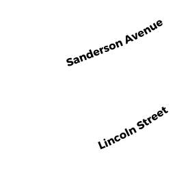
- 56 LINCOLN ST
Single Family Residential owned by FLINN CHRISTOPHER J ETUX - 60 LINCOLN ST
Single Family Residential owned by GREENWOOD MICHAEL J ETUX - 79 MONROE ST
Single Family Residential owned by RICHARDS SERINA T - 78 MONROE ST
Single Family Residential owned by PODOLSKI ANDREW ETUX - 117 CEDAR ST
Single Family Residential owned by LOUGHRAN FAMILY IRREV TR - 22 LINCOLN ST
Single Family Residential owned by POULIOT JOSEPH ETUX - 28 LINCOLN ST
Single Family Residential owned by RUTHERFORD KIMBERLY B - 34 LINCOLN ST
Single Family Residential owned by CAWLEY THOMAS ETUX - 40 LINCOLN ST
Single Family Residential owned by KAHLER GLORIA A - 48 LINCOLN ST
Single Family Residential owned by O'TOOLE RYAN M ETUX - 50 LINCOLN ST
Vacant, Education (Municipal or County) owned by DEDHAM TOWN OF - 54 LINCOLN ST
Single Family Residential owned by JEANNE P ANDERSON TR 2017 THE - 18 LINCOLN ST
Single Family Residential owned by GALLAGHER MARK K ETUX - 12 LINCOLN ST
Single Family Residential owned by STONIER MARC R ETUX - 75 MADISON ST
Single Family Residential owned by HELLER ANNE S